mapz.com offers comprehensive global map material for download and further editing on your computer. You can access the required map for immediate download using our map editor. Our maps are available as high-resolution JPG, PNG or PDF files, or in editable EPS format.
We also offer an API, a print API, embed codes and WMS services, which allow you to add our maps to websites and apps, and use them in GIS and BI systems.
Our maps are available in two different designs, and with different content densities. Our “Multicolor” maps have a four-color design, as used in traditional cartography.
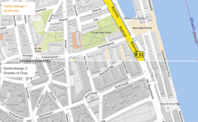
The “Shades of Gray” map design uses less color and includes less content. It is perfectly suited to infographics and thematic maps.
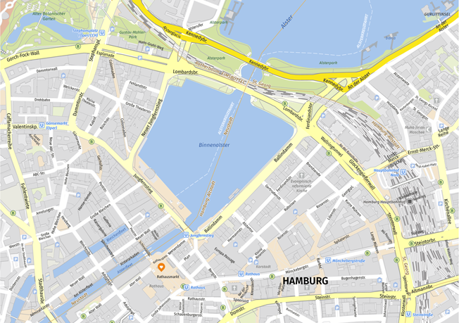
The sample maps available for download below will give you a good impression of the quality of our city, regional and country maps.
PNG is a raster graphics format with lossless compression. It supports a wide range of color depths and alpha channel transparency. It is the lossless graphics format most commonly used in online applications.
JPG files are compatible with all image editing software and widely-used office packages. The format offers high compression and small files sizes. mapz.com provides JPG files with medium compression, which are largely free of compression artefacts and ensure a high-quality map image.
Our newest development offers Photoshop (PSD) files with two layers, so text elements can be moved or deleted easily and without the relatively higher costs of vector files. All the text elements, signatures and objects added by the user are gathered on the second layer – for the same price as a PNG or JPG file and from 100 dpi. Take care! PSD is an Adobe Photoshop file format that can only be edited using Photoshop.
mapz vector files offer full graphic flexibility. They can be printed in high resolution and edited as required using software like Adobe Illustrator or the free program Inkscape.
All the elements of our maps have an individual color value, which can be used to make selections. This method (selection by color) allows content elements of a specific type to be selected and assigned to separate layers using vector graphics software (e.g. Adobe Illustrator). For example, it lets you amend the colors of motorway networks, built up areas or pictograms such as car parks, or select and amend the capital cities on a map of Europe as a group.
Use the following steps to make a selection in Adobe Illustrator:
Horizontal text elements maintain line by line and are fully editable. Text elements which are aligned and rotated on curves (paths) are quite different: for technical reasons these are provided in fragments, which may complicate the processing.
We have replaced the font used in the past, Dejavu Sans, with the open source font Fira Sans by Erik Spiekermann. You can download the free font at fonts.google.com
The content and appearance of our maps can be adapted to your specific needs before download. The integrated drawing tool allows you to insert markers, highlight areas and add labels.
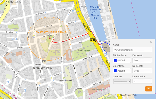
Our wide range of markers makes it easy to show and number important details, routes and locations. The radius function is a particular highlight: For example, it can show the distance to public transport stops near your flat at the click of a mouse. You can color, move, amend and delete all the elements created using the editing tool as necessary. The tool does not require any additional software or specialist design and programming knowledge.
Downloading our vector files gives you full graphic flexibility. Unlike pixel images, vector files allow you to manipulate and edit all the objects shown on the map directly, using software like Adobe Illustrator or the free program Inkscape.
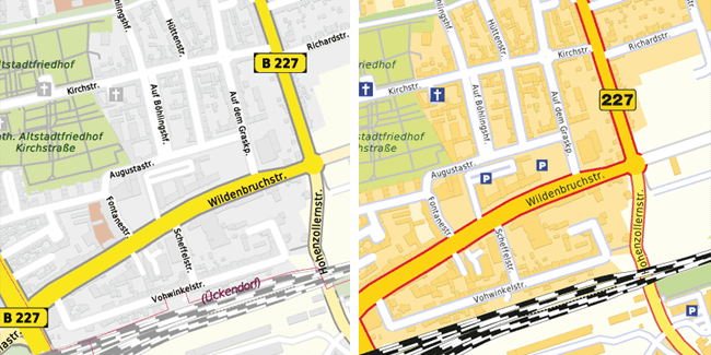
Vector files give you to option to change the colors of specific elements, rather than making general changes to color values. The grey outlines of the roads in the image below were colored red without changing any other grey elements.
Abstract maps, so-called area of interest maps and maps with reduced levels of content are easy to create using vector files.
Our maps are generated from database data by sophisticated algorithms at the moment of download, using area and scale parameters defined by the user. The available area – the paper format – has a direct effect on the level of detail in the labels generated.
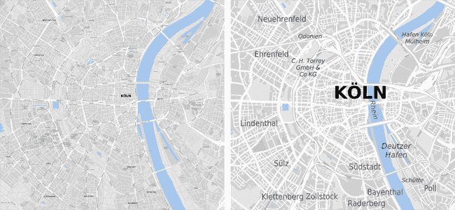
For example, if you generate a map showing part of a city for a large paper format, all the street names, and perhaps even the house numbers, will be included. However, if you generate the same map for a small paper format, then the space available for legible labels is only sufficient to show the names of neighborhoods.
In the past, a cartographer made individual decisions about whether a single street would be labelled once or several times, or whether a long street name would be split across two lines. The results of this conscious process are the standard by which we judge all maps, even though today’s maps are generated by computers according to mathematical rules.
Despite the high performance of our server system, it is still a technical challenge to ensure that the labels and content generated are always legible, to achieve the required level of detail, and to produce a high-quality, visually appealing cartographic image – just like a map designed by a human cartographer.