... real estate agents know that better than most. When they buy property, families want to know how their children will get to school, and companies value good public transport links for their employees. In the retail industry pedestrian traffic is essential, while logistics companies need rapid motorway connections and access to major transshipment points.
While real estate agents need maps with the highest possible level of detail for their flyers, research departments require clearly presented basic maps that offer an overview of the region.
Our maps meet the needs of the real estate industry – whether for traditional flyers and market reports, or for use on a broker’s website.
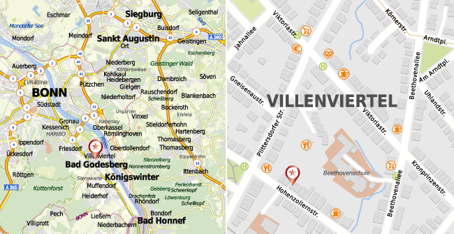
We offer a variety of map designs for different applications, with a uniform appearance at every zoom level.
Our maps can be downloaded to a local computer for further editing. You can also use embed codes and our API to add maps to your website or project marketing microsites. And the API allows high resolution maps to be used by software packages for real estate management and administration.
With our integrated drawing tools, you can color cities and regions, or add locations and labels, with just a few clicks of a mouse. You can also mark a radius or determine the dimensions of a plot. And mapz.com offers a comprehensive library of the most important pictograms for points of interest. The size and color of any marked areas can be set individually, so there is no need to edit the map in an additional graphics program.
As well as traditional maps with a variety of designs and content densities, mapz.com offers official real estate maps and aerial photographs of most several German federal states. Further maps will be added as soon as the relevant technical and licensing requirements have been created by the authorities.
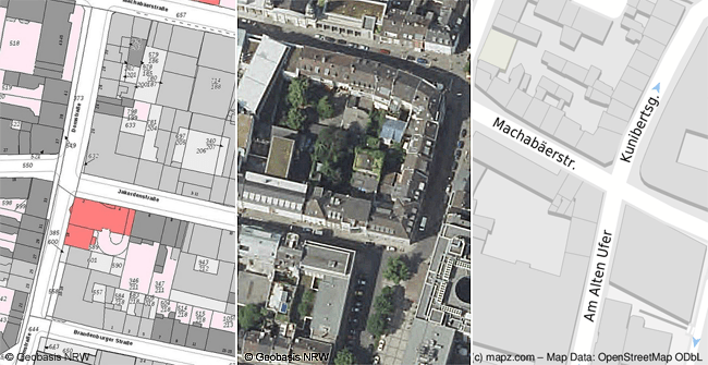
Our integrated drawing tools allow you to determine area dimensions and distances using official real estate maps.
Numerous processes can be fully automated using the mapz.com API. It makes it easy to add maps to websites, and integrate them into real estate software for flyer production, using simple database-driven retrieval.
The maps on your website are updated dynamically every time you make a change to your property database or we amend our cartographic data.
The same is true of flyer production: Your real estate software can access high resolution maps for flyers with simple commands, using our print API. That means the maps and property data are always up-to-date when a flyer is generated.
→ Further information about the API
→ Further information about the print API